San Luis Obispo weatherWhat’s on in San Luis Obispo →
Solvang

Get out of town

Day trips from San Luis Obispo

16 nearby parks, towns and places to explore, ordered by straight-line distance.

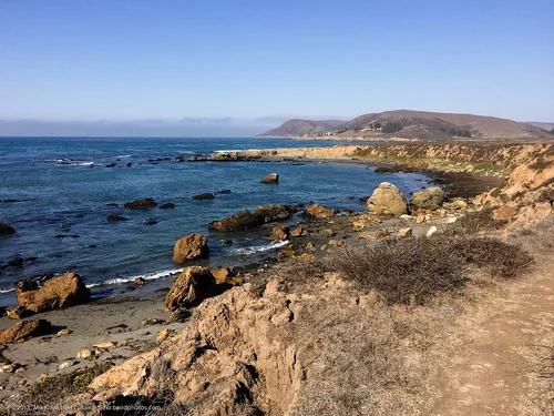
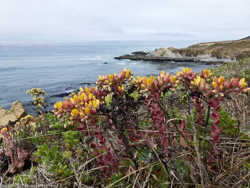
Estero Bluffs State ParkState park

Estero Bluffs State Park

19 miles northwest · straight-line distance

State park in San Luis Obispo County, California, USA.

Confirm the visitor entrance, hours, reservations, access and seasonal conditions. Islands or water destinations may require different transport.
GuadalupeTown

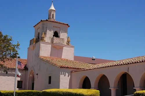
Guadalupe

22 miles south · straight-line distanceAbout 30 min by car (29 road miles, typical traffic, checked October 2026)

City in Santa Barbara County, California, United States.

Confirm the visitor entrance, hours, reservations, access and seasonal conditions. Islands or water destinations may require different transport.
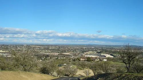
Harmony Headlands State ParkState park

Harmony Headlands State Park

23 miles northwest · straight-line distance

State park in San Luis Obispo County, California, USA.

Confirm the visitor entrance, hours, reservations, access and seasonal conditions. Islands or water destinations may require different transport.
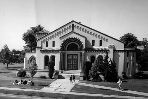
Paso RoblesTown

Paso Robles

25 miles north · straight-line distanceAbout 35 min by car (31 road miles, typical traffic, checked October 2026)

City in San Luis Obispo County, California, United States.

Confirm the visitor entrance, hours, reservations, access and seasonal conditions. Islands or water destinations may require different transport.
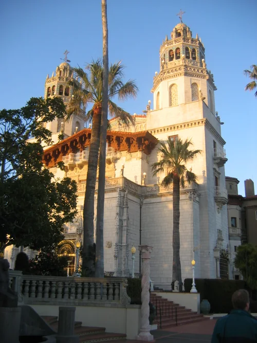
Santa MariaTown

Santa Maria

26 miles southeast · straight-line distanceAbout 35 min by car (32 road miles, typical traffic, checked October 2026)

City in southern California, United States.

Confirm the visitor entrance, hours, reservations, access and seasonal conditions. Islands or water destinations may require different transport.
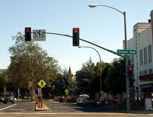
Hearst CastleThings to do

Hearst Castle

40 miles northwest · straight-line distanceAbout 1 hr 10 min by car (48 road miles, typical traffic, checked October 2026)

National Historic Landmark and California Historical Landmark located on the Central Coast of California, United States.

Confirm the visitor entrance, hours, reservations, access and seasonal conditions. Islands or water destinations may require different transport.
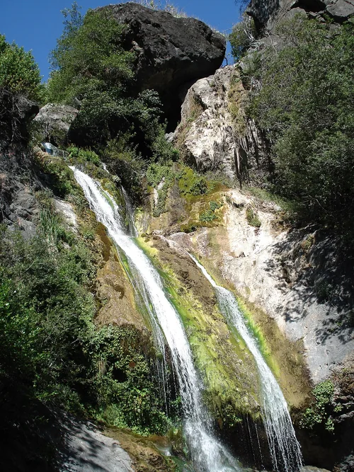
LompocTown

Lompoc

45 miles south · straight-line distanceAbout 1 hr 5 min by car (59 road miles, typical traffic, checked October 2026)

City in Santa Barbara County, California, United States.

Confirm the visitor entrance, hours, reservations, access and seasonal conditions. Islands or water destinations may require different transport.
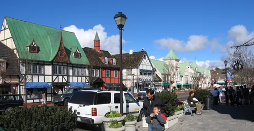
Salmon Creek FallsOutdoors

Salmon Creek Falls

54 miles northwest · straight-line distance

Waterfall.

Confirm the visitor entrance, hours, reservations, access and seasonal conditions. Islands or water destinations may require different transport.
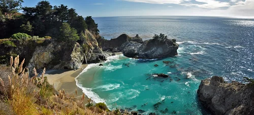
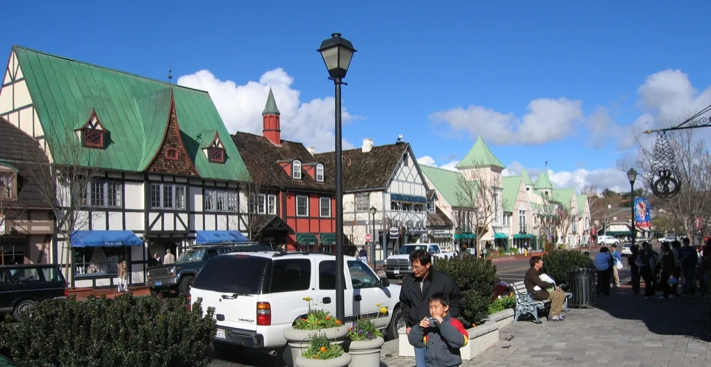
SolvangTown

Solvang

56 miles southeast · straight-line distanceAbout 1 hr 5 min by car (66 road miles, typical traffic, checked October 2026)

City in Santa Barbara County, California, United States.

Confirm the visitor entrance, hours, reservations, access and seasonal conditions. Islands or water destinations may require different transport.
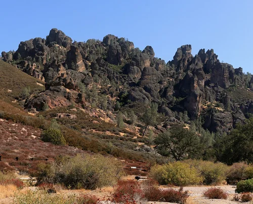
Julia Pfeiffer Burns State ParkState park

Julia Pfeiffer Burns State Park

84 miles northwest · straight-line distance

State park of California, United States.

Confirm the visitor entrance, hours, reservations, access and seasonal conditions. Islands or water destinations may require different transport.
Pinnacles National ParkNational park site

Pinnacles National Park

88 miles north · straight-line distance

National park in California, United States of America.

Confirm the visitor entrance, hours, reservations, access and seasonal conditions. Islands or water destinations may require different transport.
Outdoors

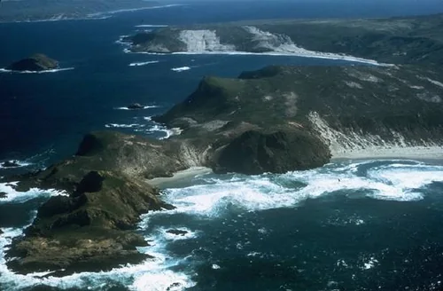
Santa Cruz Island

103 miles southeast · straight-line distance

Island in Santa Barbara County, California, United States.

Confirm the visitor entrance, hours, reservations, access and seasonal conditions. Islands or water destinations may require different transport.
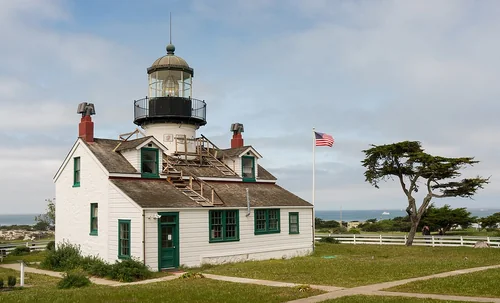
Point Pinos LighthouseOutdoors

Point Pinos Lighthouse

118 miles northwest · straight-line distanceAbout 2 hr 30 min by car (146 road miles, typical traffic, checked October 2026)

Lighthouse in California, United States.

Confirm the visitor entrance, hours, reservations, access and seasonal conditions. Islands or water destinations may require different transport.
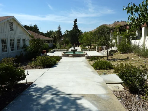
Cesar E. Chavez National MonumentNational park site

Cesar E. Chavez National Monument

119 miles east · straight-line distance

U.S. National Monument in Keene, Kern County, California.

Confirm the visitor entrance, hours, reservations, access and seasonal conditions. Islands or water destinations may require different transport.

Channel Islands National ParkNational park site

Channel Islands National Park

126 miles southeast · straight-line distance

National park of the United States.

Confirm the visitor entrance, hours, reservations, access and seasonal conditions. Islands or water destinations may require different transport.

Ronald Reagan Presidential LibraryThings to do

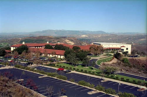
Ronald Reagan Presidential Library

126 miles southeast · straight-line distanceAbout 2 hr 40 min by car (167 road miles, typical traffic, checked October 2026)

Presidential library and museum for U.S. President Ronald Reagan in Simi Valley, California.

Confirm the visitor entrance, hours, reservations, access and seasonal conditions. Islands or water destinations may require different transport.

Driving times are typical estimates from the city center without live traffic, Powered by Geoapify · © OpenStreetMap contributors.

Distances are straight-line measurements from the city, not driving distance. Saved road estimates have no consistently recorded source date and are not current traffic; estimates to park centers, water locations or inconsistent routes are omitted. Named-destination route links are not verified entrances. Place descriptions come from Wikidata; photo credits below include recorded capture dates when available. A photograph does not show current conditions.

Outdoor places near San Luis Obispo

40 recreation areas and campgrounds within 78 miles, from Recreation.gov. Filter by what you want to do.

Recreation area

Santa Margarita Lake

10 miles northeast · straight-line distanceUS Army Corps of Engineers

Managed by San Luis Obispo County Parks, the park is set in rolling oak woodlands and offers boating, a marina and camping. Swimming and other water contact sports are prohibited.

BoatingCampingFishingPicnickingWater sportsWildlife viewing

Campground

Cerro Alto Campground

11 miles north · straight-line distanceAbout 30 min by car (23 road miles, checked October 2026)USDA Forest Service

Cerro Alto Campground is a well-known hiking and mountain biking paradise. It is located a short distance from the sandy beaches of Morro Bay, where visitors enjoy surfing, fishing, kayaking, sailing, scuba diving and more.

BikingBoatingCampingFishingHikingHuntingSwimmingWater sports

Campground

Turkey Flat Ohv Staging Area

18 miles east · straight-line distanceAbout 40 min by car (33 road miles, checked October 2026)USDA Forest Service

This facility does not accept reservations. Recreation Appealing to ATVs, quad runners, dual sports and single track riders, visitors will find access to 45 miles of marked and rated trails geared toward the beginner to experienced rider,…

BikingCamping

Recreation area

Guadalupe-Nipomo Dunes National Wildlife Refuge

19 miles south · straight-line distanceFish and Wildlife Service

The Guadalupe-Nipomo Dunes National Wildlife Refuge (Refuge) is located along the central Coast of California within the Guadalupe-Nipomo Dunes Complex, an 18-mile-long coastal dunes landscape that occupies approximately 20,000 acres of…

Ranger programs

Campground

American Canyon Campground

20 miles east · straight-line distanceAbout 2 hr 40 min by car (35 road miles, checked October 2026)USDA Forest Service

American Canyon is a small, secluded campground which borders the Machesna Wilderness. While the campground is accessible through the wilderness, it is a long and strenuous hike as vehicles are not permitted in wilderness areas.

CampingHunting

Campground

Navajo Flats Campground

21 miles east · straight-line distanceAbout 1 hr 45 min by car (37 road miles, checked October 2026)USDA Forest Service

Navajo Flat Campground, off-highway vehicle (OHV) Trailhead and day use area is an ideal location for OHV enthusiasts to enjoy the many trails in the surrounding area.

BikingCampingHikingWildlife viewing

Campground

La Panza Campground

23 miles east · straight-line distanceAbout 1 hr 5 min by car (41 road miles, checked October 2026)USDA Forest Service

La Panza Campground is full of opportunities to relax or explore the forest. Nearby is Machesna Mountain Wilderness where hiking, hunting and horseback riding are popular. Off-high vehicle (OHV) recreation is also plentiful in the area.

BikingCamping

Recreation area

Machesna Mountain Wilderness

25 miles east · straight-line distanceBureau of Land Management

The Machesna Mountain Wilderness now contains a total of 19,882 acres and is managed by the Bureau of Land Management and the Forest Service. All of the Wilderness is in the state of California.

Wilderness

Recreation area

Point Sal

26 miles south · straight-line distanceBureau of Land Management

Point Sal is a 77-acre promontory on the coast of northern Santa Barbara County near the north end of Vandenberg Air Force Base. It is a fragile area, with sandy soil and a unique blend of wildlife.

HikingWildlife viewing

Campground

Horseshoe Springs Campground

36 miles southeast · straight-line distanceUSDA Forest Service

Nestled in large grove of oaks. Campground provides solitude for those seeking that type of experience.

Camping

Recreation area

Soda Lake Boardwalk

43 miles east · straight-line distanceBureau of Land Management

A walk along the boardwalk offers solitude and beauty among the different plants. Even in summertime, the area has a special beauty with numerous white dust devils spinning across the dusty alkaline playas.

HikingPhotographyRanger programsWildlife viewing

Recreation area

Soda Lake Overlook

43 miles east · straight-line distanceBureau of Land Management

A normally dry lake bed, covers an area of about 3,000 acres. It is the largest remaining natural alkali wetland in southern California and the only closed basin within the coastal mountains.

HikingHorseback ridingPhotographyWildlife viewing

Recreation area

Saucito Ranch

44 miles east · straight-line distanceBureau of Land Management

The El Saucito Ranch house is the oldest standing house in the Carrizo Plain National Monument, dating back to circa 1878. This is the only ranch house in the monument to have been occupied from the pioneer period to modern day.

HikingHorseback ridingPhotographyRanger programsWildlife viewing

Recreation area

Goodwin Education Center

46 miles east · straight-line distanceBureau of Land Management

The center offers the visitor interpretive displays and exhibits explaining the uniqueness of the Carrizo Plain and adjoining Elkhorn Plain.

Nature educationPhotographyRanger programsWildlife viewing

Recreation area

Painted Rock

46 miles east · straight-line distanceBureau of Land Management

The sandstone formation at Painted Rock has long drawn the attention of Carrizo Plain National Monument visitors. About 3,000 - 4,000 years ago, Native Americans began to paint their sacred images with the alcove of the rock.

HikingWildlife viewing

Recreation area

Wallace Creek

47 miles east · straight-line distanceBureau of Land Management

Here you are standing on the San Andreas Fault. At this location it runs northwest to southeast a the base of the hills.

HikingHorseback ridingPhotographyRanger programsWildlife viewing

Campground

Selby Campground

48 miles east · straight-line distanceAbout 1 hr 55 min by car (75 road miles, checked October 2026)Bureau of Land Management

Camping is available on a first come-first serve basis. Thirteen campsites with picnic tables, fire pits, horse corrals and a wheelchair accessible vault toilet. Electricity and drinking water is not available.

CampingHikingHorseback ridingPhotographyWildlife viewing

Recreation area

Stockdale Mountain

50 miles north · straight-line distanceBureau of Land Management

Private property surrounds Stockdale Mountain. Do not enter through private gates or fences.

BikingCampingHikingHorseback ridingHuntingPhotographyWildlife viewing

Campground

Mt. Figueroa Campground

53 miles southeast · straight-line distanceAbout 1 hr 30 min by car (73 road miles, checked October 2026)USDA Forest Service

Experience life elevated when you enjoy vistas of wildflowers, star gazing, and summer campouts atop Figueroa Mountain.

BikingCamping

Recreation area

Williams Hill

53 miles north · straight-line distanceBureau of Land Management

Located in southern Monterey County, and standing over 2,700 feet in elevation, Williams Hill offers great views of the surrounding Salinas Valley.

BikingCampingHikingHorseback ridingOff-highway vehiclesPhotographyWildlife viewing

Campground

Davy Brown Campground

54 miles southeast · straight-line distanceAbout 1 hr 50 min by car (84 road miles, checked October 2026)USDA Forest Service

Nestled on beautiful Figueroa Mountain, this charming campground sits alongside the serenely flowing Davy Brown Creek.

BikingCamping

Campground

KCL Campground

54 miles east · straight-line distanceAbout 2 hr 5 min by car (81 road miles, checked October 2026)Bureau of Land Management

Camping is available on a first come-first serve basis--we do not take reservations. The campground has 12 campsites, 3 with elevated tent pads. There is an accessible vault toilet, along with picnic tables and fire rings.

CampingHikingHorseback ridingPhotographyWildlife viewing

Campground

Nira Campground

54 miles southeast · straight-line distanceAbout 1 hr 55 min by car (86 road miles, checked October 2026)USDA Forest Service

Nira Campground is a beautiful site covered in oak trees and located along Manzana Creek.

BikingCamping

Recreation area

Curry Mountain

56 miles north · straight-line distanceBureau of Land Management

Parking access onto nearly 1,800 acres of Bureau of Land Management property in this area is provided through an easement from the California Department of Fish and Game.

BikingCampingHikingHorseback ridingHuntingPhotographyWildlife viewing

Recreation area

Carrizo Plain National Monument

59 miles east · straight-line distanceBureau of Land Management

All vehicles including UTVs on the monument must be street-legal (DMV plated) and all vehicles must stay on roads. REMINDER: Please follow warning signs and respect private property when visiting your public lands.

BikingCampingHorseback ridingHuntingNature educationPhotographyWildlife viewing

Recreation area

Van Matre Ranch

60 miles east · straight-line distanceBureau of Land Management

The Van Matre family owned several farm properties throughout the plain. This property, known to them as "The Camp" was orginally homesteaded by Jerry Hagerty in 1930.

HikingHorseback ridingPhotographyWildlife viewing

Recreation area

Coalinga Mineral Springs

61 miles north · straight-line distanceBureau of Land Management

The Coalinga Mineral Springs National Recreation Trail was designated under the National Recreation Trails System Act in 1981. The trail is located on the scenic southern tip of the Diablo Mountains.

BikingCampingHikingHorseback ridingHuntingPhotographyWildlife viewing

Recreation area

Traver Ranch

61 miles east · straight-line distanceBureau of Land Management

The Traver Ranch was established in the 1940's when the family purchased approximately 800 acres and began building the large block house that still stands along the edge of Soda Lake Road.

HikingHorseback ridingPhotographyRanger programsWildlife viewing

Recreation area

Cachuma Lake

62 miles southeast · straight-line distanceBureau of Reclamation

Cachuma Reservoir, formed by Bradbury Dam , offers a prime recreational opportunity for the south central coast area of California.

BikingBoatingCampingFishingHikingHorseback ridingHotel/Lodge/Resort Fs OwnedNature education

Campground

Plaskett Creek Campground

63 miles northwest · straight-line distanceAbout 1 hr 20 min by car (73 road miles, checked October 2026)USDA Forest Service

Plaskett Creek Campground offers a beautiful location just minutes from Sand Dollar Beach, one of the largest and most popular beaches in central California.

BikingCampingFishingHikingHuntingWildlife viewing

Campground

Ponderosa Campground

64 miles northwest · straight-line distanceUSDA Forest Service

Ponderosa Campground offers visitors a beautiful location to relax and enjoy nature. It runs along the Nacimiento River, which provides a variety of recreational opportunities.

BikingCampingFishingHikingHistoryHuntingSwimmingWildlife viewing

Recreation area

Temblor Recreation Area

65 miles east · straight-line distanceBureau of Land Management

Temblor Recreation Area was newly designated in the Bakersfield RMP (December 2014) and provides opportunities for OHV riding on a network of over 200 miles of designated routes, recreational shooting, hunting, and other dispersed forms of…

BikingCampingHikingHorseback ridingHuntingOff-highway vehiclesPhotographyWildlife viewing

Campground

Kirk Creek Campground

68 miles northwest · straight-line distanceAbout 1 hr 25 min by car (78 road miles, checked October 2026)USDA Forest Service

Kirk Creek Campground is an oceanside paradise, with each site overlooking the Pacific Ocean. It offers a variety of opportunities for relaxation and recreation.

BikingBoatingCampingFishingHikingHuntingWater sportsWildlife viewing

Recreation area

Condon Peak

70 miles north · straight-line distanceBureau of Land Management

Located on the outskirts of the Clear Creek Management Area (CCMA), Condon Peak offers rolling grass-covered slopes with a few tall pines and shrubs, as well as steep slopes and rocky outcrops covered with pine and brush.

BikingCampingHikingHorseback ridingPhotographyWildlife viewing

Recreation area

Kern National Wildlife Refuge

70 miles northeast · straight-line distanceFish and Wildlife Service

For thousands of years, California's Central Valley has provided habitat for millions of waterfowl, shorebirds and other wetland dependent species.

HikingHunting

Campground

Los Prietos

70 miles southeast · straight-line distanceAbout 1 hr 25 min by car (82 road miles, checked October 2026)USDA Forest Service

Los Prietos Campground is situated in the Los Padres National Forest and provides access to a variety of outdoor adventures, including water-related recreation and hiking.

BikingCampingFishingSwimming

Campground

Paradise Campground

70 miles southeast · straight-line distanceAbout 1 hr 25 min by car (82 road miles, checked October 2026)USDA Forest Service

Paradise Campground is a beautiful place to enjoy California's westernmost national forest. It provides access to a variety of recreational activities, including hiking, biking, horseback riding and more.

CampingFishingHikingHuntingSwimming

Recreation area

Atwell Recreation Area

76 miles northeast · straight-line distanceBureau of Land Management

Atwell Island Restoration Project (AIP) is located in the historic Ton Tache Wetland basin and the Sand Ridge on the southern edge of Historic Tulare Lake.

Bird Watching

Recreation area

Laguna Mountain

76 miles north · straight-line distanceBureau of Land Management

The Laguna Mountain Area consists of somewhat rugged terrain with rolling hills covered in dense brush. The area's vegetation is characterized by classic chapparal habitat, oak forests, and grassy meadows.

BikingCampingHikingHorseback ridingHuntingPhotographyWildlife viewing

Recreation area

Los Padres National Forest

78 miles southeast · straight-line distanceUSDA Forest Service

BikingCampingClimbingHikingOff-highway vehiclesPicnickingSwimmingWater sports

Recreation areas and campgrounds from Recreation.gov's directory, checked October 9, 2026. Listings are not live availability: check Recreation.gov or the managing agency for open dates, fees, reservations and conditions. Directions go to the listed coordinates, which may not be the entrance. Campground driving times: Powered by Geoapify · © OpenStreetMap contributors.

Questions

What day-trip ideas are near San Luis Obispo?

This guide includes Estero Bluffs State Park, Guadalupe, Harmony Headlands State Park, Paso Robles, Santa Maria. Places are ordered by straight-line distance. Confirm visitor access, opening hours and current travel conditions before choosing a trip.

How far is Estero Bluffs State Park from San Luis Obispo?

Approximately 19 miles northwest in a straight line. This is not current traffic or a route to a verified visitor entrance. Use the named destination and confirm the appropriate entrance or transport.

How far is Guadalupe from San Luis Obispo?

Approximately 22 miles south in a straight line; driving takes about 30 min over 29 road miles in typical traffic (Geoapify, checked October 2026). This is not current traffic or a route to a verified visitor entrance. Use the named destination and confirm the appropriate entrance or transport.

How far is Harmony Headlands State Park from San Luis Obispo?

Approximately 23 miles northwest in a straight line. This is not current traffic or a route to a verified visitor entrance. Use the named destination and confirm the appropriate entrance or transport.

Where can I camp near San Luis Obispo?

Recreation.gov lists 16 campgrounds within 70 miles, including Cerro Alto Campground (11 miles north), Turkey Flat Ohv Staging Area (18 miles east), American Canyon Campground (20 miles east). Check Recreation.gov for current availability, seasons and reservations.

San Luis Obispo AI

Your San Luis Obispo local guide
Hey there!

I'm San Luis Obispo AI. Ask about neighborhood food, independent shops, local history or planning a visit.

AI recommendations may be inaccurate. Verify hours and prices. Questions are processed by Cloudflare. Privacy