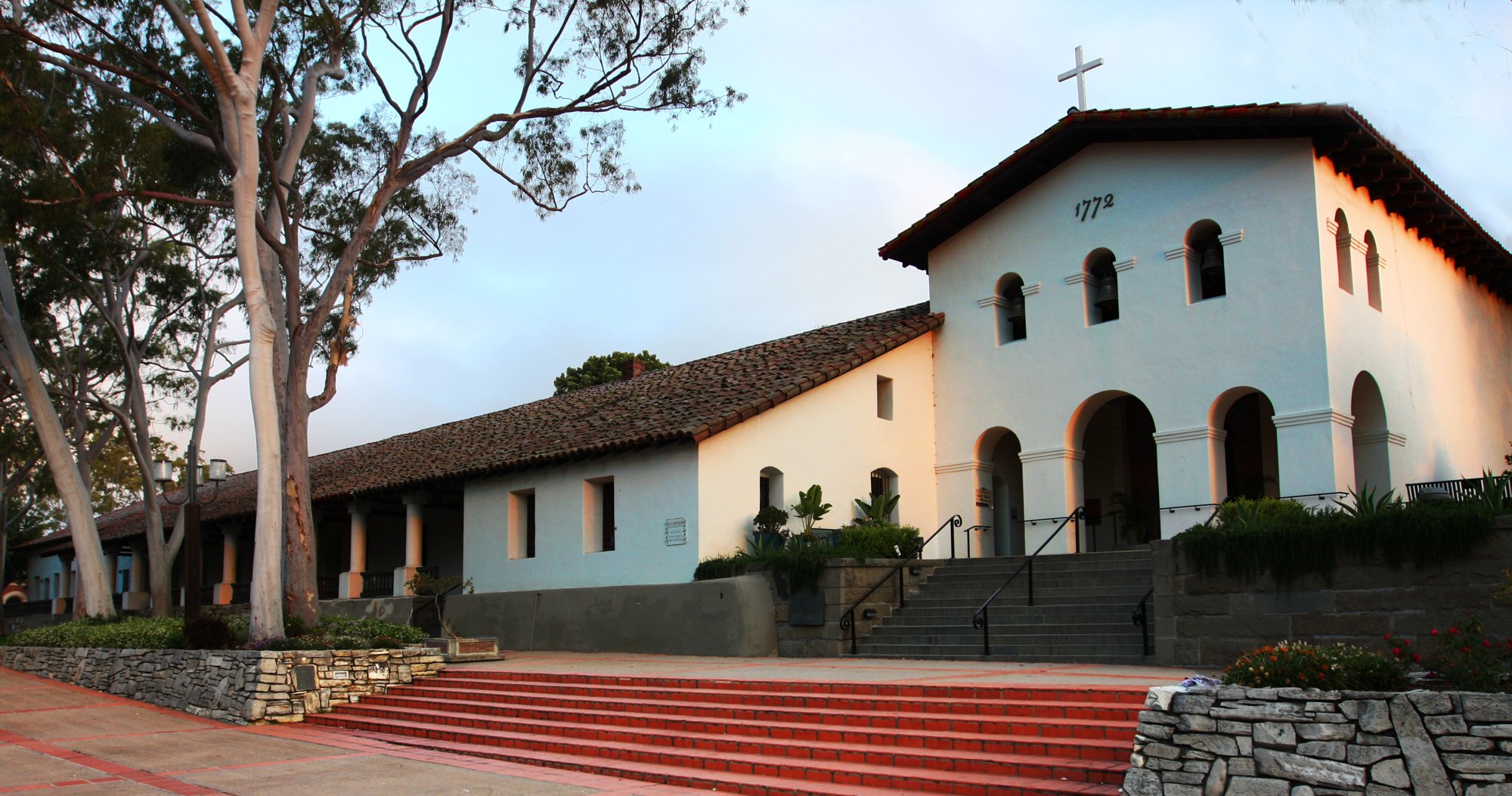
Mission San Luis Obispo de Tolosa

Outdoors

Wildlife viewing and birding near San Luis Obispo

Refuges, lakes and wild areas near San Luis Obispo for wildlife viewing and birdwatching.

Good to know: Early mornings and evenings are best for wildlife; bring binoculars and keep a respectful distance.

Within 30 miles (4)

10 mi northeast · US Army Corps of Engineers

Santa Margarita Lake

Managed by San Luis Obispo County Parks, the park is set in rolling oak woodlands and offers boating, a marina and camping. Swimming and other water contact sports are prohibited.

  • Boating
  • Camping
  • Fishing
  • Picnicking
  • Water sports
  • Wildlife viewing

11 mi north · USDA Forest Service · Campground

Cerro Alto Campground

Cerro Alto Campground is a well-known hiking and mountain biking paradise. It is located a short distance from the sandy beaches of Morro Bay, where visitors enjoy surfing, fishing, kayaking, sailing, scuba diving and more.

  • Biking
  • Boating
  • Camping
  • Fishing
  • Hiking
  • Hunting
  • Swimming
  • Water sports

21 mi east · USDA Forest Service · Campground

Navajo Flats Campground

Navajo Flat Campground, off-highway vehicle (OHV) Trailhead and day use area is an ideal location for OHV enthusiasts to enjoy the many trails in the surrounding area.

  • Biking
  • Camping
  • Hiking
  • Wildlife viewing

26 mi south · Bureau of Land Management

Point Sal

Point Sal is a 77-acre promontory on the coast of northern Santa Barbara County near the north end of Vandenberg Air Force Base. It is a fragile area, with sandy soil and a unique blend of wildlife.

  • Hiking
  • Wildlife viewing

30 to 75 miles (20)

43 mi east · Bureau of Land Management

Soda Lake Boardwalk

A walk along the boardwalk offers solitude and beauty among the different plants. Even in summertime, the area has a special beauty with numerous white dust devils spinning across the dusty alkaline playas.

  • Hiking
  • Photography
  • Ranger programs
  • Wildlife viewing

44 mi east · Bureau of Land Management

Saucito Ranch

The El Saucito Ranch house is the oldest standing house in the Carrizo Plain National Monument, dating back to circa 1878. This is the only ranch house in the monument to have been occupied from the pioneer period to modern day.

  • Hiking
  • Horseback riding
  • Photography
  • Ranger programs
  • Wildlife viewing

46 mi east · Bureau of Land Management

Goodwin Education Center

The center offers the visitor interpretive displays and exhibits explaining the uniqueness of the Carrizo Plain and adjoining Elkhorn Plain.

  • Nature education
  • Photography
  • Ranger programs
  • Wildlife viewing

46 mi east · Bureau of Land Management

Painted Rock

The sandstone formation at Painted Rock has long drawn the attention of Carrizo Plain National Monument visitors. About 3,000 - 4,000 years ago, Native Americans began to paint their sacred images with the alcove of the rock.

  • Hiking
  • Wildlife viewing

47 mi east · Bureau of Land Management

Wallace Creek

Here you are standing on the San Andreas Fault. At this location it runs northwest to southeast a the base of the hills.

  • Hiking
  • Horseback riding
  • Photography
  • Ranger programs
  • Wildlife viewing

48 mi east · Bureau of Land Management · Campground

Selby Campground

Camping is available on a first come-first serve basis. Thirteen campsites with picnic tables, fire pits, horse corrals and a wheelchair accessible vault toilet. Electricity and drinking water is not available.

  • Camping
  • Hiking
  • Horseback riding
  • Photography
  • Wildlife viewing

50 mi north · Bureau of Land Management

Stockdale Mountain

Private property surrounds Stockdale Mountain. Do not enter through private gates or fences.

  • Biking
  • Camping
  • Hiking
  • Horseback riding
  • Hunting
  • Photography
  • Wildlife viewing

53 mi north · Bureau of Land Management

Williams Hill

Located in southern Monterey County, and standing over 2,700 feet in elevation, Williams Hill offers great views of the surrounding Salinas Valley.

  • Biking
  • Camping
  • Hiking
  • Horseback riding
  • Off-highway vehicles
  • Photography
  • Wildlife viewing

54 mi east · Bureau of Land Management · Campground

KCL Campground

Camping is available on a first come-first serve basis--we do not take reservations. The campground has 12 campsites, 3 with elevated tent pads. There is an accessible vault toilet, along with picnic tables and fire rings.

  • Camping
  • Hiking
  • Horseback riding
  • Photography
  • Wildlife viewing

56 mi north · Bureau of Land Management

Curry Mountain

Parking access onto nearly 1,800 acres of Bureau of Land Management property in this area is provided through an easement from the California Department of Fish and Game.

  • Biking
  • Camping
  • Hiking
  • Horseback riding
  • Hunting
  • Photography
  • Wildlife viewing

59 mi east · Bureau of Land Management

Carrizo Plain National Monument

All vehicles including UTVs on the monument must be street-legal (DMV plated) and all vehicles must stay on roads. REMINDER: Please follow warning signs and respect private property when visiting your public lands.

  • Biking
  • Camping
  • Horseback riding
  • Hunting
  • Nature education
  • Photography
  • Wildlife viewing

60 mi east · Bureau of Land Management

Van Matre Ranch

The Van Matre family owned several farm properties throughout the plain. This property, known to them as "The Camp" was orginally homesteaded by Jerry Hagerty in 1930.

  • Hiking
  • Horseback riding
  • Photography
  • Wildlife viewing

61 mi north · Bureau of Land Management

Coalinga Mineral Springs

The Coalinga Mineral Springs National Recreation Trail was designated under the National Recreation Trails System Act in 1981. The trail is located on the scenic southern tip of the Diablo Mountains.

  • Biking
  • Camping
  • Hiking
  • Horseback riding
  • Hunting
  • Photography
  • Wildlife viewing

61 mi east · Bureau of Land Management

Traver Ranch

The Traver Ranch was established in the 1940's when the family purchased approximately 800 acres and began building the large block house that still stands along the edge of Soda Lake Road.

  • Hiking
  • Horseback riding
  • Photography
  • Ranger programs
  • Wildlife viewing

62 mi southeast · Bureau of Reclamation

Cachuma Lake

Cachuma Reservoir, formed by Bradbury Dam , offers a prime recreational opportunity for the south central coast area of California.

  • Biking
  • Boating
  • Camping
  • Fishing
  • Hiking
  • Horseback riding
  • Hotel/Lodge/Resort Fs Owned
  • Nature education

63 mi northwest · USDA Forest Service · Campground

Plaskett Creek Campground

Plaskett Creek Campground offers a beautiful location just minutes from Sand Dollar Beach, one of the largest and most popular beaches in central California.

  • Biking
  • Camping
  • Fishing
  • Hiking
  • Hunting
  • Wildlife viewing

64 mi northwest · USDA Forest Service · Campground

Ponderosa Campground

Ponderosa Campground offers visitors a beautiful location to relax and enjoy nature. It runs along the Nacimiento River, which provides a variety of recreational opportunities.

  • Biking
  • Camping
  • Fishing
  • Hiking
  • History
  • Hunting
  • Swimming
  • Wildlife viewing

65 mi east · Bureau of Land Management

Temblor Recreation Area

Temblor Recreation Area was newly designated in the Bakersfield RMP (December 2014) and provides opportunities for OHV riding on a network of over 200 miles of designated routes, recreational shooting, hunting, and other dispersed forms of…

  • Biking
  • Camping
  • Hiking
  • Horseback riding
  • Hunting
  • Off-highway vehicles
  • Photography
  • Wildlife viewing

68 mi northwest · USDA Forest Service · Campground

Kirk Creek Campground

Kirk Creek Campground is an oceanside paradise, with each site overlooking the Pacific Ocean. It offers a variety of opportunities for relaxation and recreation.

  • Biking
  • Boating
  • Camping
  • Fishing
  • Hiking
  • Hunting
  • Water sports
  • Wildlife viewing

70 mi north · Bureau of Land Management

Condon Peak

Located on the outskirts of the Clear Creek Management Area (CCMA), Condon Peak offers rolling grass-covered slopes with a few tall pines and shrubs, as well as steep slopes and rocky outcrops covered with pine and brush.

  • Biking
  • Camping
  • Hiking
  • Horseback riding
  • Photography
  • Wildlife viewing

75 miles and farther (1)

76 mi north · Bureau of Land Management

Laguna Mountain

The Laguna Mountain Area consists of somewhat rugged terrain with rolling hills covered in dense brush. The area's vegetation is characterized by classic chapparal habitat, oak forests, and grassy meadows.

  • Biking
  • Camping
  • Hiking
  • Horseback riding
  • Hunting
  • Photography
  • Wildlife viewing

Distances are straight-line miles from downtown San Luis Obispo. Listings come from Recreation.gov’s federal recreation database; check each official page for hours, fees, fire restrictions and closures before you go.

More outdoors near San Luis Obispo

Questions

Where is the closest place for wildlife & birding near San Luis Obispo?

Santa Margarita Lake (US Army Corps of Engineers), about 10 miles northeast of San Luis Obispo as the crow flies. Next are Cerro Alto Campground (11 mi) and Navajo Flats Campground (21 mi).

Who manages these places?

Federal agencies including Bureau of Land Management, USDA Forest Service, US Army Corps of Engineers. Each listing links to its official page for hours, fees, closures and current conditions.

San Luis Obispo AI

Your San Luis Obispo local guide
Hey there!

I'm San Luis Obispo AI. Ask about neighborhood food, independent shops, local history or planning a visit.

AI recommendations may be inaccurate. Verify hours and prices. Questions are processed by Cloudflare. Privacy